


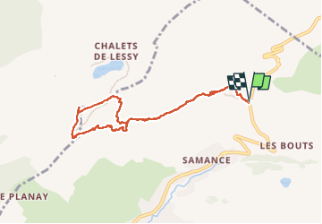
Aiguille verte, Col et lac de Lessy

GrouGary
Gebruiker

Lengte
8,1 km

Max. hoogte
2008 m

Positief hoogteverschil
615 m
Km-Effort
16,3 km

Min. hoogte
1419 m

Negatief hoogteverschil
612 m
Boucle
Ja
Datum van aanmaak :
2024-05-25 07:05:09.515
Laatste wijziging :
2024-05-28 13:20:55.999
3h26
Moeilijkheid : Medium

Gratisgps-wandelapplicatie
 SityTrail
IGN / Geografische instituten
SityTrail Plus
De wereld gaat voor u open
Over ons
Tocht Stappen van 8,1 km beschikbaar op Auvergne-Rhône-Alpes, Haute-Savoie, Le Grand-Bornand. Deze tocht wordt voorgesteld door GrouGary.
Beschrijving
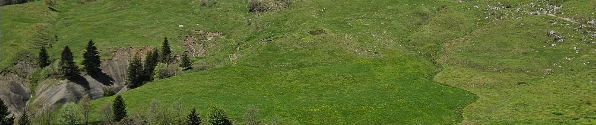
Parcours sans difficulté, avec montée dans les alpages (vaches et chevres). Retour par le col de Lessy et descente plus raide sur sente directe.
Foto's


Plaatsbepaling
Land:
France
Regio :
Auvergne-Rhône-Alpes
Departement/Provincie :
Haute-Savoie
Gemeente :
Le Grand-Bornand
Locatie:
Unknown
Vertrek:(Dec)
Vertrek:(UTM)
303668 ; 5095298 (32T) N.
Opmerkingen